
GIS Survey Services
About Us
Welcome to GIS Survey Services and GEO
Transforming vision into reality with precision and innovation
GIS Survey Services and GEO is a trusted pan India surveying and geospatial solutions company, dedicated to delivering end-to-end land surveying, GIS mapping and geospatial data solutions.
Our team of 250+ experienced professionals combines technical expertise, precision and innovation to transform your project vision into a measurable reality.
From initial feasibility surveys to final as-built documentation, we ensure that every phase of your project is executed with precision and transparency. Our data is processed and reviewed daily to maintain project timelines and ensure the highest standards of integrity. Every modification to the survey data is carefully tracked, ensuring complete accountability and accuracy.
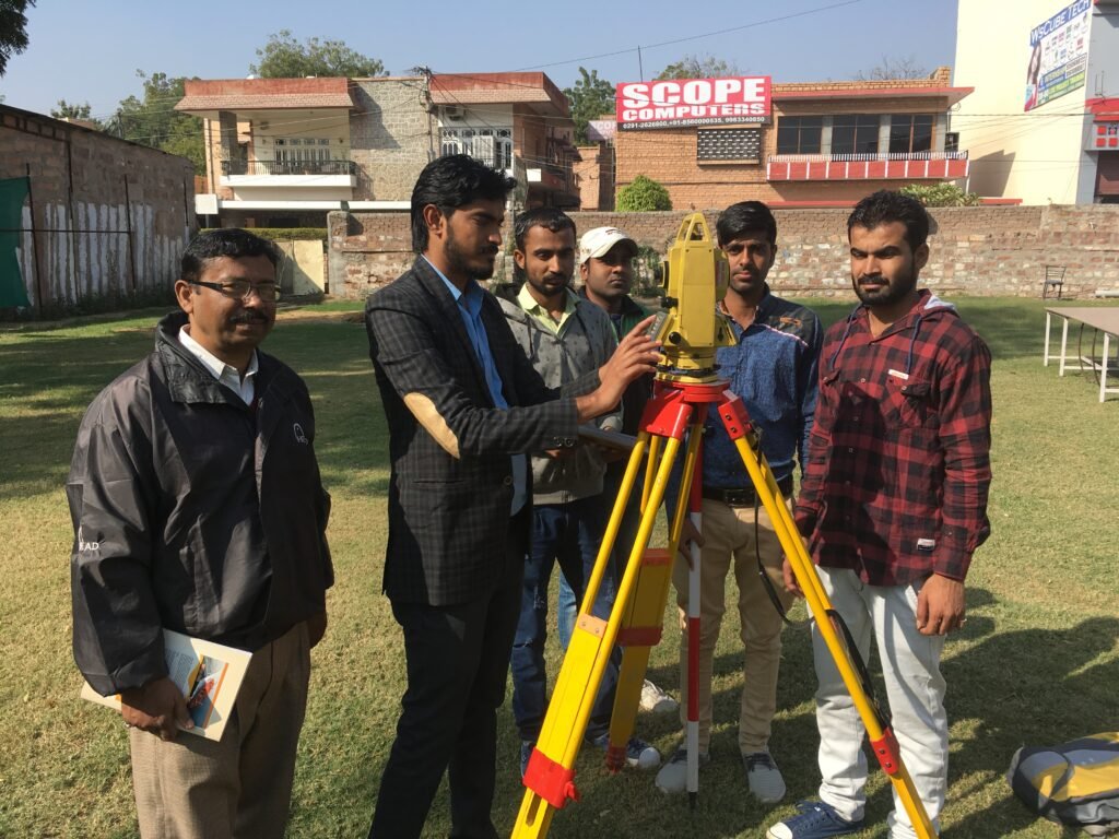
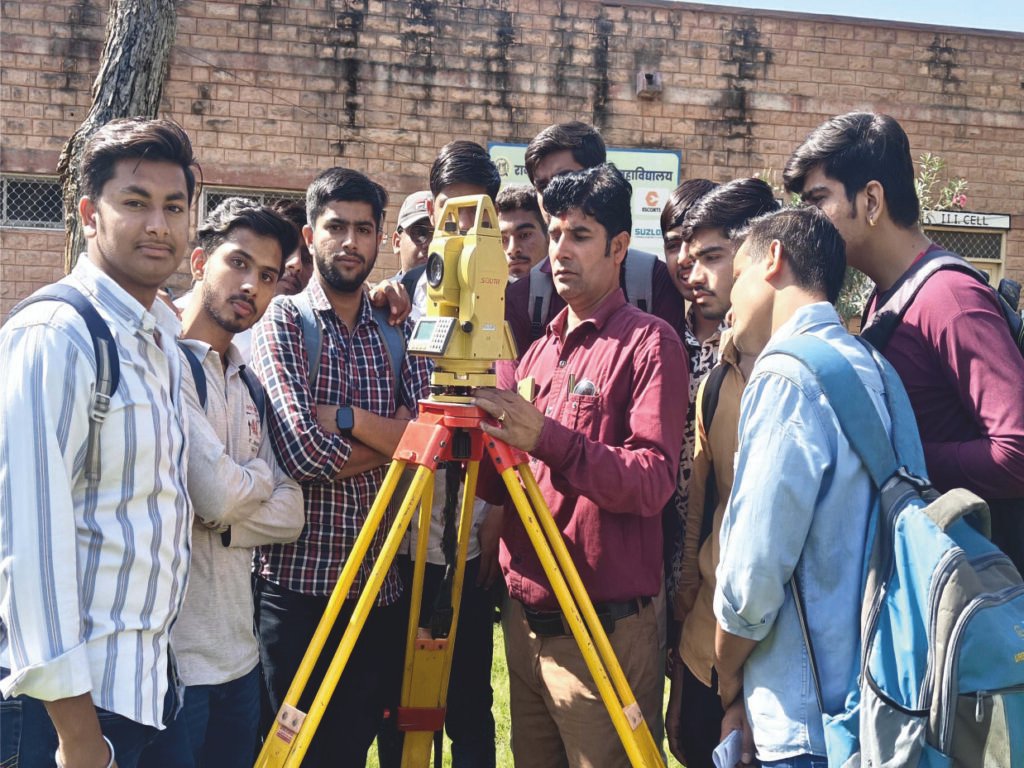
Building Staffs
Our building staff is trained in advanced GIS survey services to ensure accurate mapping and data accuracy. They deliver reliable results for every land and infrastructure project.
History Emphasis
With our expert GIS survey services, we analyze historical land data to preserve and understand geographic evolution. Our focus is on accuracy, legacy, and spatial insight.
Economic Outcomes
Our GIS survey services help drive better economic outcomes by optimizing land use, planning and resource management. We transform spatial data into smart financial decisions.
Our Journey
Established in 1995, the GEO surveyors and GIS survey services began their operations in Jodhpur, Rajasthan, with a mission to support engineering and infrastructure areas with credible survey and CAD drafting solutions. Over the years, our services expanded computer aided design and drafting (CADD) and Geospaceial Information System (GIS) services to include wide, high quality solutions under a roof-a wide, high quality solutions under the roof.
Our GIS Survey Services Include:
- Topographic and land limit survey.
- GIS mapping and spatial data analysis.
- Route and correctly survey.
- Construction layout and surveyed survey.
- Diligence and acquisition survey.
- Cadd drafting and mapping solutions.
- Counseling for developers, builders and government projects
Our Vision
To empower the youth of India with knowledge and skills in modern survey and GIS technologies, to create more awareness and opportunities in the field. We imagine a future where efficient professional will promote the development of infrastructure, reduce unemployment and contribute to India’s development through accuracy and innovation.
Our Mission
Our mission is to educate, motivate and equip individuals with practical understanding of survey equipment, techniques and applications. We try to bridge the difference of knowledge in the industry by spreading awareness about sustainable infrastructure and the importance of geopolitical data in the creation of smart communities.
Our Purpose
Establishing Jio Surveyors and GIS as one of the top land survey and GIS companies in India, providing customers across the country accurate, transparent and technologically-operated solutions. Our goal is to proceed with honesty, provide extraordinary services and work together for better, data-operated future.
325
Revenue in 2017 (Million)
525
Collaegues & Counting
302
Successfully Project
25
Year of experience
Mr. Nishat Khan
Director, Gio Surveyor and GIS Survey Services
Mr. Nishat Khan is the Jio Surveyors and Director of GIS Survey Services , conducting a diploma in civil engineering with more than 20 years of experience in the field of survey and geophysical technology. They have intensive expertise in drone survey, DGP and total station survey equipment, which brings innovation and accuracy to every project. Under its visionary leadership, the GEO surveyor and GIS have evolved into a rapidly growing and reliable survey organization since its inception in 1995, providing excellence in India.

Sustainability
Committed To Keep People Healthy & Safe
With advanced GIS tools, we transform complex land data into easy-to-understand visual maps. Get a complete geospatial solution designed for accuracy and efficiency.
We Follow Best Practices
We provide expert GIS survey services for accurate mapping, spatial analysis and data visualization. Our team ensures accuracy, reliability and modern technology in every project.
- Sustainablility
- Project On Time
- Modern Technology
- Latest Designs