
Introduction to UAV Surveying
UAV surveying has become one of the most advanced and efficient methods for capturing land data with exceptional accuracy. Using unmanned aerial vehicles, surveyors can collect detailed measurements, images, and terrain information from above. This approach has changed the way land is analyzed and mapped, making the entire process faster, safer and more reliable. Geo Land Survey uses UAV technology to help customers better understand their lands and make informed decisions for development, planning and construction.
What a UAV Survey Really Means
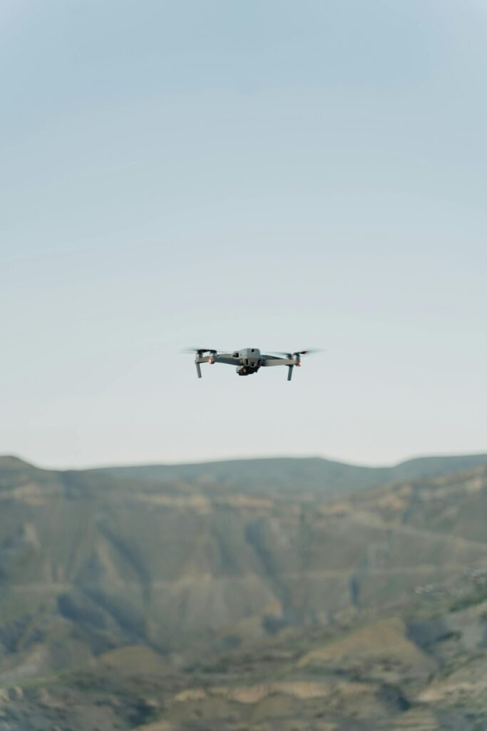
UAV surveying is the use of drones to collect spatial data from the sky. These drones fly above the ground and capture high-resolution images and measurements using cameras, sensors, and GPS systems. The information collected is later processed into accurate maps, models and representations of the terrain. UAV provides clarity on elevation, land size, boundaries and structures. This level of detail is extremely useful for developers, engineers, farmers and planners who require accurate and verified land information.
Works in the Field
The UAV process begins with planning the survey area and creating an automated flight path. Once the drone is airborne, it captures images from multiple angles and overlaps them for detailed mapping. The drone continuously records its position using GPS to ensure accuracy. After flight, the data is processed using photogrammetry or LiDAR software to produce maps, 3D terrain models and digital elevation outputs. Geo Land Survey conducts each UAV survey with a combination of advanced drones and skilled survey professionals to maintain high quality results.
Why UAV Is More Efficient
The biggest advantage of UAV survey technology is its speed and efficiency. Traditional surveys often require long periods of fieldwork, manual measurements, and physical access to the entire land area. A UAV accomplishes this task in less time while providing more detailed data. Drones can cover large lands, uneven terrain and inaccessible areas without risk. This makes UAV surveying ideal for large projects, rugged landscapes, and dispersed land parcels. Geo Land Survey uses UAV survey systems to reduce project time while improving accuracy.
UAV Survey and Modern Mapping Technology
UAV surveying is not just about flying drones; It is deeply connected to advanced mapping software and digital tools. High-quality sensors, aerial imaging, 3D modeling software, and GIS technology all work together to convert aerial images into accurate land maps. Outputs include orthomosaic maps, contour lines, digital terrain models, and volumetric data. These layers of information help planners visualize the land in a way that is not possible with ground-based methods alone. Geo Land Survey integrates UAV survey data with GIS systems to provide professional and ready-to-use maps.
Applications of UAV Survey in Different Sectors
The demand for UAV is increasing in many industries. In construction, it helps assess land before development, track progress, and verify measurements. Mining companies use UAV data to calculate excavation volumes and monitor safety. Agricultural fields use UAV techniques to analyze soil health, crop patterns, and irrigation requirements. Urban planners rely on aerial mapping to study land use and terrain behavior. Geo Land Survey provides customized UAV survey solutions for each region, ensuring that customers receive relevant and impactful data.
Why UAV Survey Is Important for Large Projects
Large infrastructure and property development projects require extensive land measurement. Traditional survey methods may take weeks or even months, especially on uneven or inaccessible land. A UAV survey can complete the same job quickly while producing more detailed results. Developers receive accurate topographic data, enabling smoother planning and fewer errors during construction. At Geo Land Survey, UAV survey technology is used extensively for large layouts, highways, industrial sites and real estate projects to ensure precise land planning.
Safety and Environmental Benefits of UAV
One of the major benefits of using UAV technology is safety. Surveyors no longer need to enter dangerous areas, wade through dense vegetation or climb steep ground. Drones operate from the sky, reducing risk and improving efficiency. UAV surveying also minimizes disturbance to the environment as the drone operates quietly and does not damage natural features. Geo Land Survey maintains strict safety practices and environmentally responsible methods during each UAV survey mission.
How Geo Land Survey Ensures Accuracy in UAV Surveys
Geo Land Survey follows a systematic approach to ensure that each UAV is accurate and reliable. This includes flight planning, precise GPS control, high quality image capture, ground control point setup, and careful data processing. Each output is reviewed by professionals to ensure it meets technical standards. Clients receive complete survey reports that include maps, models and visual data to aid planning, construction and decision making. Accuracy and transparency remain the core strengths of every UAV survey completed by Geo Land Survey.
Conclusion
UAV surveying has become an essential part of modern land assessment, bringing speed, accuracy and convenience to land measurement and mapping. Its ability to capture detailed data from above makes it a valuable tool for developers, engineers, farmers and planners. Geo Land Survey continues to adopt the latest UAV technologies to provide high quality land insights. With accurate aerial data, every project becomes safer, smarter and more efficient, helping customers move forward with confidence.