
DGPS Survey: Complete Guide to Accurate Land Surveying Using DGPS Technology
A DGPS Survey is one of the most accurate methods used for measuring land, mapping terrain, and collecting geographic data. In India, DGPS technology is widely used in infrastructure projects, highway construction, mining, agriculture, land development, utility mapping, and government surveying projects. By improving the accuracy of traditional satellite positioning systems, DGPS helps surveyors collect highly reliable location data.
Modern land surveying requires precision because even small measurement errors can affect planning, construction, and legal documentation. This is why many surveyors use DGPS equipment to achieve accurate positioning and dependable survey results.
What Is DGPS?
DGPS stands for Differential Global Positioning System. It is an enhanced form of the Global Positioning System (GPS) that improves positioning accuracy by correcting errors in satellite signals.
Purpose of DGPS Technology
The primary purpose of DGPS is to reduce location errors that occur in standard GPS measurements. It provides more accurate coordinates that can be used for surveying, mapping, and engineering applications.
Components of a DGPS System
A typical DGPS setup consists of a base station and a rover receiver. The base station is positioned at a known location, while the rover collects data from different points within the survey area.
Applications of DGPS
DGPS is commonly used for land surveys, road projects, railway alignment, utility mapping, mining operations, and geographic information system (GIS) data collection.
What Is DGPS Survey?
A DGPS Survey is a surveying method that uses Differential GPS technology to determine precise positions on the Earth’s surface.
Purpose of a DGPS Survey
The survey helps establish accurate coordinates, property boundaries, elevations, and topographic features required for planning and development projects.
Equipment Used in DGPS Surveys
Surveyors typically use GNSS receivers, base stations, rover units, controllers, and data processing software to perform the survey.
Common Survey Applications
DGPS surveys are frequently conducted for land acquisition, construction planning, infrastructure development, route alignment, and mapping projects.
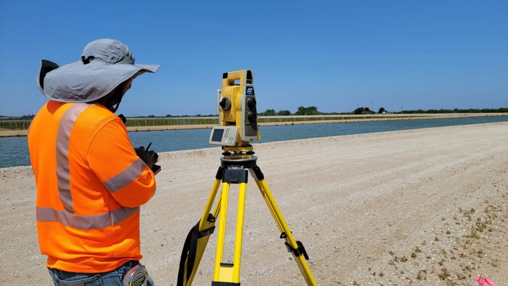
How Does DGPS Work?
DGPS works by comparing satellite signals received at a known location with the actual coordinates of that location.
Satellite Signal Reception
Both the base station and rover receiver receive signals from multiple navigation satellites orbiting the Earth.
Error Calculation
The base station identifies differences between its known coordinates and the coordinates calculated from satellite signals. These differences represent positioning errors.
Applying Corrections
Correction information is transmitted to the rover receiver, allowing it to adjust measurements and improve accuracy significantly.
Generating Accurate Coordinates
After corrections are applied, the rover calculates highly accurate positions that can be used for professional surveying tasks.
Difference Between GPS and DGPS
Although GPS and DGPS both use satellite positioning technology, their accuracy levels differ significantly.
Accuracy Levels
Standard GPS generally provides meter-level accuracy, while DGPS can achieve sub-meter or centimeter-level accuracy depending on the equipment and survey method.
Error Correction Capability
GPS relies solely on satellite signals, whereas DGPS uses correction data from a reference station to improve positioning results.
Surveying Applications
GPS is suitable for navigation and general location tracking, while DGPS is preferred for professional surveying and engineering projects.
Reliability in Land Measurement
DGPS provides more dependable results for boundary determination, mapping, and construction-related surveys.
Importance of DGPS in Surveying
Accurate measurements are essential for successful surveying projects, making DGPS an important technology in modern surveying.
Improved Survey Accuracy
The technology helps surveyors collect precise coordinates that support engineering and development projects.
Faster Data Collection
Large areas can be surveyed efficiently without the need for extensive traditional measurements.
Reduced Survey Errors
Correction mechanisms help minimize positioning errors and improve confidence in survey results.
Support for Digital Mapping
DGPS data can be integrated into GIS, CAD, and mapping software for further analysis and project planning.
DGPS Accuracy
One of the main reasons surveyors use DGPS is its high level of positioning accuracy.
Factors Affecting Accuracy
Satellite geometry, atmospheric conditions, equipment quality, and survey procedures can influence results.
Typical Accuracy Levels
Many DGPS systems achieve sub-meter accuracy, while advanced RTK-based systems can provide centimeter-level precision under suitable conditions.
Accuracy Verification
Surveyors often perform quality checks and repeated observations to validate measurements.
Importance in Engineering Projects
High accuracy is essential for road alignment, building construction, utility installation, and boundary surveys.
Satellite Based Positioning
Satellite-based positioning forms the foundation of GPS and DGPS technologies.
Navigation Satellite Systems
Positioning systems use signals from satellite constellations such as GPS, GLONASS, Galileo, and BeiDou.
Determining Coordinates
Receivers calculate their position by measuring distances to multiple satellites.
Role in Surveying
Satellite positioning allows surveyors to establish accurate coordinates over large geographic areas.
Modern Survey Applications
Many modern surveying projects depend on satellite-based positioning for efficient data collection and mapping.
Land Survey Using DGPS
Land Survey Using DGPS is widely adopted for property measurement and infrastructure development.
Boundary Surveys
Surveyors use DGPS to identify and verify property boundaries accurately.
Topographic Surveys
The technology helps collect elevation and terrain information for planning and design purposes.
Infrastructure Projects
Roads, railways, pipelines, and utility networks often require DGPS-based surveys during project development.
Government and Private Sector Applications
Both public agencies and private organizations rely on DGPS for accurate land information.

DGPS Advantages
DGPS offers several benefits compared to conventional positioning methods.
High Precision
The technology provides significantly better accuracy than standard GPS.
Time Efficiency
Large survey areas can be measured quickly and efficiently.
Digital Data Collection
Survey data can be processed directly into mapping and design software.
Versatility
DGPS can be used across various industries, including construction, agriculture, mining, and urban planning.
Using Drone in Survey
Drone technology is increasingly being combined with DGPS to improve surveying efficiency.
Aerial Data Collection
Drones can capture images and geographic data from large areas in a short period.
Access to Difficult Terrain
Steep slopes, water bodies, and remote locations can be surveyed more easily using drones.
Mapping and Modeling
Drone imagery can be processed into orthomosaics, digital elevation models, and 3D representations.
Integration with DGPS
DGPS provides accurate ground control points that improve the accuracy of drone-generated mapping products.
Geo Land Survey – Experts in DGPS and Drone Surveys
Geo Land Survey provides professional surveying solutions using modern DGPS and drone technologies.
Advanced Survey Equipment
Professional-grade GNSS receivers, DGPS systems, and drone platforms are used to collect accurate field data.
Comprehensive Survey Services
Services include land surveys, topographic surveys, route surveys, GIS mapping, drone surveys, and infrastructure surveys.
Skilled Survey Professionals
Experienced surveyors and mapping specialists ensure accuracy throughout the project lifecycle.
Commitment to Quality
By combining modern technology with professional expertise, Geo Land Survey delivers reliable survey solutions for residential, commercial, industrial, and government projects.
Conclusion
DGPS Survey has become an essential part of modern land surveying because of its ability to deliver highly accurate positioning data. From boundary surveys and topographic mapping to infrastructure development and drone-based data collection, DGPS technology supports a wide range of applications. Understanding how DGPS works, its advantages, and its role in satellite-based positioning helps property owners, engineers, developers, and government agencies make better decisions based on accurate geographic information.