
Introduction to UAV Land Surveying
UAV Land Surveying has revolutionized the way land is measured, mapped and analyzed. Using unmanned aerial vehicles equipped with high-precision sensors, this technique allows surveyors to collect accurate land data from the sky. UAV Land Survey is now widely used across construction, infrastructure, agriculture and environmental projects because it delivers faster results, safer field operations and highly detailed mapping. Geo Land Survey integrates this advanced technology into its services to provide clients with reliable and professional land insights.
What UAV Land Surveying Means
UAV land surveying refers to the use of drones to capture spatial and topographic data on land surfaces. These drones fly over a target area following a predetermined path, taking hundreds or thousands of overlapping aerial images. The images are then processed into accurate maps, 3D land models and digital elevation data. UAV land surveying provides a complete view of terrain, boundaries, slopes and land features, making it one of the most powerful tools available in modern surveying.
How UAV Land Surveying Works
The process of UAV land surveying begins with careful planning. Surveyors determine flight altitude, coverage area, ground control points, and data requirements before launching the drone. Once airborne, the UAV captures high-resolution images with precise GPS tagging. After flight, advanced photogrammetry software converts the images into measurable ground models. At Geo Land Survey, each step of UAV land survey is performed with strict accuracy to ensure that customers receive reliable and well-processed survey outputs.
Benefits of UAV Land Surveying
The rise of UAV land surveying is driven by its accuracy, efficiency, and ability to handle large areas quickly. Traditional land surveys often require manual movement on site, which can be time-consuming or even risky in difficult terrain. UAV land surveying eliminates these challenges by collecting data from above. This method covers wide land areas in a fraction of the time while maintaining high precision. It also produces more detailed terrain data, helping customers make well-informed decisions.
UAV Land Surveying in Construction Projects
Construction projects rely heavily on accurate land data, and UAV land surveying plays a major role in providing this foundation. Developers use drone-based mapping to understand the elevation, slope, contours and existing structures of the land before planning their layout. UAVs help land survey engineers design drainage systems, evaluate foundation conditions, and monitor site progress throughout construction. Geo Land Survey uses drone data to help contractors create advanced plans that reduce errors and ensure smooth project execution.
Role of UAV Land Surveying in Agriculture
Significant improvement in agriculture has been observed through UAV land survey. Farmers and landowners use drone-based analytics to study soil conditions, crop health, irrigation patterns and land suitability. UAV land surveying provides accurate acreage calculations, helps identify low yield areas and assists in planning farm layouts. Geo Land Survey provides specialized UAV services for agricultural customers who want accurate land measurements and better resource planning.
UAV Land Surveying for Mining and Quarrying
Mining sites often cover large areas and uneven terrain that are difficult to measure using traditional methods. UAV land surveying allows safe and fast assessment of mines, pits and stockpiles. Drones capture detailed images that help calculate volume, slope, excavation progress and safety concerns. Geo Land Survey uses UAV land surveys to deliver reliable data for mining companies that require accurate and frequent monitoring.
Why UAV Land Surveying Improves Safety
The biggest advantage of UAV land surveying is improved safety in field operations. Surveyors no longer need to navigate dangerous areas, steep surfaces or dense vegetation. Drones collect data from the sky, reducing physical risk and minimizing disruption to the natural landscape. Geo Land Survey emphasizes safe and responsible field practices, making UAV land survey the preferred choice for challenging locations.
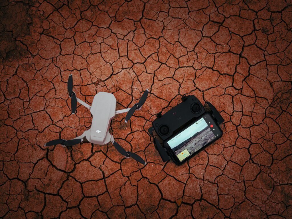
Technology Behind UAV Land Survey
UAV land surveying relies on advanced equipment such as high-resolution cameras, LiDAR sensors, RTK GPS systems, and photogrammetry software. These technologies work together to provide accurate land data. The drone takes aerial photographs while maintaining precise position control. The data is then processed to produce digital elevation models, Orth mosaic maps, contour lines and 3D terrain views. Geo Land Surveys uses industry-leading UAV systems to ensure that each survey meets professional standards.
How Geo Land Survey Ensures Quality in UAV Land Surveying
To ensure that each UAV land survey project is accurate, Geo Land Survey follows a detailed and technical workflow. The team uses ground control points to increase measurement accuracy, processes the imagery using advanced software and verifies the results before final delivery. Clients receive complete survey reports, including maps, terrain models and measurement files that support engineering, planning and development needs. Quality, accuracy and transparency are at the core of Geo Land Survey’s UAV land survey services.
Conclusion
UAV land surveying has become an essential part of modern land assessment and development. Its speed, accuracy, and ability to capture detailed aerial data make it superior to many traditional methods. Whether used for construction, agriculture, mining or land development, UAV land surveys provide information that drives better planning and stronger decision making. Geo Land Survey is leading the way in this field by using the latest UAV technologies to provide high quality and reliable land survey services.