
LiDAR Survey
A LiDAR Survey is one of the most advanced surveying methods available today for collecting highly accurate spatial data. Using laser-based technology, LiDAR can rapidly measure the Earth’s surface and create detailed three-dimensional representations of terrain, buildings, vegetation, and infrastructure. Because of its speed and precision, LiDAR surveying has become an essential tool in industries such as land surveying, construction, mining, forestry, transportation, and environmental management.
Unlike traditional surveying methods that require extensive field measurements, a LiDAR Survey can collect millions of data points within a short period. This enables surveyors and engineers to obtain detailed information about large areas while improving efficiency and reducing project timelines.
What Is a LiDAR Survey?
A LiDAR Survey is a surveying technique that uses laser pulses to measure distances between a sensor and objects on the ground. LiDAR stands for Light Detection and Ranging. The technology determines distance by measuring the time it takes for a laser pulse to travel to an object and return to the sensor.
According to NOAA and NASA, LiDAR technology can generate highly accurate elevation and surface models by collecting large numbers of measurements known as point clouds. These point clouds are then processed into maps and three-dimensional models.
Definition
A LiDAR Survey is the process of collecting geographic and elevation data using laser scanning technology to create accurate digital representations of the Earth’s surface and surrounding features.
What Does LiDAR Stand For?
LiDAR stands for Light Detection and Ranging. The technology uses laser light to measure distances and determine the position of objects with high precision.
Why LiDAR Surveying Is Important
LiDAR surveying provides accurate terrain information that supports planning, engineering design, construction, environmental monitoring, and infrastructure development. The ability to collect data quickly over large areas makes it particularly valuable for modern surveying projects.
How a LiDAR Survey Works
LiDAR technology operates by emitting laser pulses toward the ground and measuring the time required for those pulses to return to the sensor. Since the speed of light is known, the system can calculate the distance between the sensor and the target with a high degree of accuracy.
The collected measurements are combined with positioning data from GPS, GNSS, and inertial navigation systems to generate precise geographic coordinates.
Laser Pulse Measurement
The LiDAR sensor continuously emits laser pulses toward the Earth’s surface. Each pulse reflects off an object and returns to the sensor, allowing the system to calculate distance based on travel time.
Point Cloud Generation
Every laser return creates a data point. Millions of these points combine to form a dense point cloud that represents the surveyed area in three dimensions.
Positioning Systems Used in LiDAR
LiDAR systems rely on GNSS receivers and Inertial Measurement Units (IMUs) to accurately determine the position and orientation of the sensor during data collection.
Data Processing and Mapping
After data collection, the point cloud is processed using specialized software to generate maps, Digital Elevation Models (DEMs), Digital Terrain Models (DTMs), contours, and three-dimensional visualizations.
Types of LiDAR Survey
Different LiDAR survey methods are used depending on project requirements, site conditions, and desired outputs.
Airborne Survey
Airborne LiDAR systems are mounted on airplanes or helicopters and are used to survey large geographic areas efficiently. This method is commonly used for topographic mapping, flood studies, and regional planning.
Drone Survey
Drone-mounted LiDAR systems combine the flexibility of unmanned aerial vehicles with laser scanning technology. Drone LiDAR surveys are ideal for smaller project areas, construction sites, mining operations, and infrastructure inspections.
Mobile Survey
Mobile LiDAR systems are mounted on vehicles and collect data while traveling along roads, highways, railways, and urban environments. This method allows rapid acquisition of corridor mapping data.
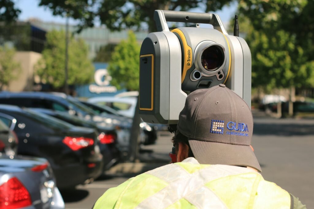
Terrestrial Survey
Terrestrial LiDAR uses ground-based laser scanners mounted on tripods or mobile platforms. It is widely used for building surveys, industrial facilities, heritage documentation, and engineering projects.
Equipment Used in a LiDAR Survey
Several technologies work together to perform a successful LiDAR Survey.
LiDAR Sensor
The LiDAR sensor is responsible for emitting laser pulses and recording reflected signals. It serves as the primary data collection component of the system.
GPS and GNSS Receivers
GPS and GNSS receivers determine the precise location of the LiDAR sensor during data collection, ensuring accurate georeferencing of the survey data.
Inertial Measurement Unit (IMU)
An IMU measures the orientation, rotation, and movement of the survey platform. This information is essential for accurately positioning the collected LiDAR data.
Data Processing Software
Specialized software processes raw LiDAR point clouds into useful deliverables such as contour maps, terrain models, orthomosaics, and three-dimensional visualizations.
Applications of LiDAR Survey
LiDAR Survey technology supports a wide range of industries and applications due to its accuracy and efficiency.
Topographic Mapping
LiDAR is commonly used to create topographic maps, contour maps, and elevation models for engineering, land development, and planning projects.
Construction and Infrastructure
Construction professionals use LiDAR surveys for site planning, earthwork calculations, corridor mapping, road design, and infrastructure development.
Mining and Volume Calculations
Mining companies use LiDAR surveys to calculate stockpile volumes, monitor excavation activities, and manage resources more effectively.
Forestry and Environmental Studies
LiDAR technology helps measure forest canopy height, vegetation density, biomass, watershed characteristics, and environmental changes over time.
Benefits of LiDAR Survey
The growing popularity of LiDAR surveying is driven by several important advantages.
High Accuracy
LiDAR systems provide highly accurate elevation and positional data, making them suitable for engineering and surveying applications that require precise measurements.
Fast Data Collection
LiDAR can collect millions of measurements within a short time, significantly reducing fieldwork duration compared to traditional surveying methods.
Ability to Capture Dense Terrain Data
The technology produces dense point clouds that provide detailed representations of terrain, structures, and surrounding features.
Effective in Vegetated Areas
One of the major advantages of LiDAR is its ability to capture ground elevation through gaps in vegetation, making it particularly useful in forested environments.
Limitations of LiDAR Survey
Although LiDAR Survey offers many advantages, it also has certain limitations.
Higher Equipment Costs
LiDAR systems are generally more expensive than traditional surveying equipment due to the advanced technology involved.
Complex Data Processing
Large LiDAR datasets require specialized software, computing resources, and technical expertise to process and analyze effectively.
Weather and Environmental Factors
Heavy rain, fog, and adverse weather conditions can affect LiDAR performance and data quality during survey operations.
Why Choose Geo Land Survey for LiDAR Survey Services?
At Geo Land Survey, we use advanced LiDAR Survey technology to provide accurate and reliable geospatial data for construction, infrastructure, mining, land development, and environmental projects. Our experienced team combines modern surveying techniques with professional expertise to deliver high-quality results that support informed decision-making.
Whether you require topographic mapping, terrain modeling, volume calculations, or infrastructure surveys, Geo Land Survey offers tailored LiDAR solutions designed to meet your project requirements.
Conclusion
A LiDAR Survey is one of the most efficient and accurate methods for collecting geographic and elevation data. By using laser pulses, GNSS positioning, and advanced processing software, LiDAR technology creates highly detailed three-dimensional models of the Earth’s surface.
Its ability to collect large amounts of data quickly, accurately, and efficiently has made LiDAR an essential tool for surveying, engineering, construction, mining, forestry, and environmental management. As technology continues to evolve, LiDAR Survey applications will continue to expand across industries that depend on precise spatial information.
Frequently Asked Questions About LiDAR Survey
What is a LiDAR Survey?
A LiDAR Survey is a laser-based surveying method that measures distances and collects elevation data to create detailed maps and three-dimensional models.
How accurate is a LiDAR Survey?
The accuracy depends on the equipment, survey method, and project requirements, but LiDAR is widely recognized for producing highly accurate elevation and terrain data.
What is the difference between LiDAR and Photogrammetry?
LiDAR uses laser pulses to measure distances, while photogrammetry uses overlapping photographs to create maps and models. LiDAR is often more effective for capturing terrain beneath vegetation.
What industries use LiDAR Survey?
LiDAR Survey is widely used in land surveying, construction, mining, forestry, transportation, environmental monitoring, and infrastructure development.
Can LiDAR work through vegetation?
LiDAR can penetrate gaps within vegetation and capture ground elevation beneath forest canopies more effectively than traditional photographic mapping methods.