
How to Get Into Drone Surveying
The surveying industry has experienced significant technological advancements in recent years, and one of the most exciting developments is drone surveying. Drones have transformed the way surveyors collect data, create maps, and manage large-scale projects. As demand for faster and more accurate surveying solutions continues to grow, many students and professionals are exploring opportunities in this rapidly expanding field.
If you are interested in building a career in surveying, learning about drone technology can open the door to exciting job opportunities in construction, infrastructure, mining, agriculture, and land development. Understanding the skills, training, and equipment required can help you successfully enter this growing profession.
What Is Drone Surveying?
Drone surveying is the process of using unmanned aerial vehicles (UAVs) to collect geographic and spatial data. Survey drones capture high-resolution images and positioning information that can be processed into maps, 3D models, contour plans, and other valuable survey deliverables.
Compared to traditional methods, drones can cover large areas quickly while maintaining a high level of accuracy. This makes them a valuable tool for modern surveying projects.
Today, drone-based surveys are commonly used for land development, topographic mapping, construction monitoring, and infrastructure planning.
Why Choose a Career in Aerial Mapping?
The demand for professionals with drone-related skills continues to increase across multiple industries.
Construction companies, engineering firms, survey organizations, mining companies, and government agencies are increasingly adopting drone technology to improve project efficiency and reduce costs.
As a result, individuals with expertise in aerial data collection and mapping often enjoy strong career prospects and opportunities for professional growth.
Learning drone technology can also provide a competitive advantage in the modern surveying industry.
Understand the Basics of Land Surveying
Before specializing in drones, it is important to understand the fundamentals of surveying.
A strong foundation in land measurement, coordinate systems, mapping principles, and boundary determination helps professionals use drone technology more effectively.
Important areas of study include:
- Surveying principles
- Mapping techniques
- Coordinate systems
- GPS and DGPS technology
- Topographic surveys
- Construction surveying
Combining traditional surveying knowledge with modern drone skills creates a valuable professional profile.
Complete Professional Training
Proper training is one of the most important steps toward entering the industry.
Individuals interested in drone surveying should learn both drone operation and survey data collection techniques. Professional training programs often include:
Drone Flight Operations
Students learn safe flight procedures, mission planning, and equipment handling.
Survey Data Collection
Training focuses on capturing accurate aerial imagery and positioning information.
Photogrammetry
Photogrammetry involves converting drone images into maps, models, and measurements.
Data Processing
Students learn to use software that transforms field data into professional survey deliverables.
Formal training helps develop the technical skills required by employers and clients.
Obtain Required Certifications
Depending on local regulations, drone operators may need specific certifications or permissions before conducting commercial operations.
Understanding aviation regulations and operating drones legally is an important part of professional development.
Certification requirements may vary based on country, project type, and drone category. Staying informed about current regulations helps ensure compliance and safe operations.
Learn Survey Software and Data Processing
Collecting aerial data is only one part of the workflow.
Survey professionals must also know how to process information and generate usable outputs. Common software applications are used for:
- Drone mapping
- Orthomosaic creation
- Contour generation
- 3D modeling
- Point cloud processing
- GIS analysis
Strong software skills can significantly improve employment opportunities and project capabilities.
Gain Practical Field Experience
Practical experience plays a major role in career development.
Working on real projects helps individuals understand site conditions, flight planning, data collection procedures, and quality control requirements.
Experience also improves problem-solving skills and helps build confidence when managing surveying projects.
Many successful professionals begin by assisting experienced surveyors before taking responsibility for larger projects.
Equipment Used in Modern Survey Projects
Understanding survey equipment is important for anyone entering the profession.
Common tools include:
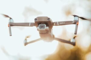
Survey Drones
These drones are equipped with cameras and sensors designed for mapping applications.
GPS and DGPS Systems
Satellite positioning technology helps improve measurement accuracy.
Ground Control Equipment
Ground control points are often used to improve data reliability.
Data Collection Devices
Field equipment supports efficient project management and documentation.
Processing Software
Specialized applications convert aerial imagery into maps and models.
Knowledge of these technologies helps professionals perform surveys more effectively.
Career Opportunities in the Industry
The growth of drone surveying has created opportunities across many sectors.
Professionals may find employment in:
- Land surveying companies
- Construction firms
- Infrastructure projects
- Mining operations
- Agriculture and precision farming
- Environmental monitoring
- Government departments
- Engineering consultancies
Some professionals also establish independent businesses offering drone mapping and surveying services.
As adoption continues to increase, career opportunities are expected to expand further.
Skills Needed for Success
Successful professionals typically develop a combination of technical and practical skills.
Important abilities include:
- Surveying knowledge
- Drone operation
- Data analysis
- Mapping skills
- Attention to detail
- Problem-solving abilities
- Communication skills
- Project management
Developing these competencies can improve both career prospects and project outcomes.
Why Drone Technology Is Transforming Surveying
Modern surveying projects often require accurate data, fast turnaround times, and efficient workflows.
Drone technology addresses these requirements by allowing professionals to collect information quickly and safely. Large areas can be surveyed in a fraction of the time required by traditional methods.
This increased efficiency has made drones an essential tool in many surveying applications.
At Geo Land Survey, advanced drone technology, DGPS systems, and modern survey equipment are used to provide accurate mapping, topographic surveys, construction surveys, and land measurement services.
Conclusion
Building a career in drone surveying can be an excellent opportunity for individuals interested in technology, mapping, and land development. By learning surveying fundamentals, completing professional training, gaining practical experience, and mastering modern software tools, aspiring professionals can position themselves for success in this growing industry.
As technology continues to evolve, drone surveying will play an increasingly important role in construction, infrastructure, engineering, and land management projects, creating exciting opportunities for skilled professionals.